


February 17th, 2024Walks of the Central Highlands

With Eve Lamb
Creswick Heritage Walk
If there’s just one walk to take visitors on while in the Creswick area, this would have to be it.
The Creswick Heritage Walk is a little beauty, chock full with points of interest and diversity despite its comparative brevity at just 8.5ks. It’s supposed to take three hours to complete but, lingering indulgently along the way, it took us about five.
It takes in the University of Melbourne’s historic Creswick Campus grounds, and the rich history of pioneering forester, arbourist and conservationist John La Gerche, incorporating the leafy La Gerche Trail with its established trees, including oaks and conifers, that were among the many species La Gerche trialled here in the late 1800s.
We set off one fine Saturday, late summer. A cracker of a day to hit the trail, equipped with the Creswick Heritage Walk map (easily obtained online courtesy of the Great Dividing Trail Network) a picnic lunch, and a sense of adventure.
The walk sets off from the town’s central Visitor Information Centre, crosses the main drag, Albert Street, and follows Victoria Street past the Creswick Water Splash Park on your left and the IGA supermarket on your right, across the Creswick Creek footbridge.
Then there’s a short stroll, to the right along Moore Street, to reach the starting point – the wrought iron gates of the University of Melbourne’s Creswick campus, formerly the School of Forestry, established 1910.
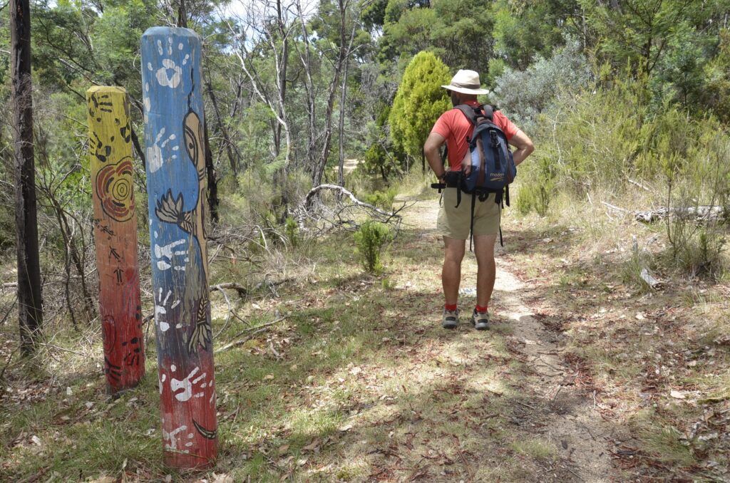
We enter the gates, admiring the park-like setting, and follow yellow-topped Goldfields Track posts heading diagonally through the campus, past the heritage- listed Victorian splendour of Tremearne House near the entrance, and past the imposing white historic façade of the former Creswick hospital, a fetching habitat for ghosts. If they existed.
The campus grounds here host some splendid old significant trees, established as part of an arboretum (grab a pamphlet from the Visitor Centre). Following the markers, we reach a sealed roadway and turn to the left to pick up the trail markers on the opposite side of the road and link with the Landcare trail, now on Parks Victoria land.
For a short stint now the trail features colourful tiles with environmental messages made by school students, and takes us to the start of the 2km long La Gerche trail winding through a diversity of conifers and the extensive Oak Gully, established more than 135yrs ago as a state nursery for rehabilitating the mined moonscape of the era.
This is a superb slice of arboreal heritage, and the great significance of La Gerche and Creswick’s role in the state’s forestry and conservation heritage is detailed on plaques, markers and monuments along the way.
As it’s getting on lunch time we take a good moment here to soak in the cool ambience and appreciate this special place, its history and its living presence.
The sandwiches and home-baked black forest cake that Paddy H thoughtfully packed go down a treat in the depths of the Oak Gully, but eventually it’s time to move on as we’ve got a walk to finish.
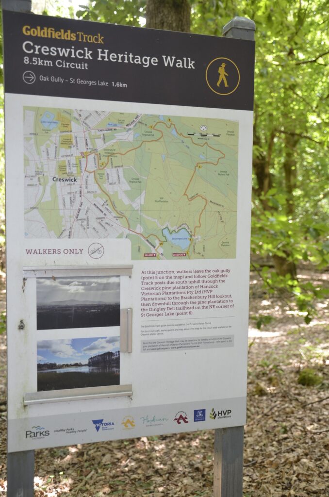
It’s easy to find the right place to turn off and leave the forested La Gerche trail, as the correct point to do so is well marked with signage boards. Look out for them in the Oak Gully and you can’t miss ‘em.
Leaving the leafy La Gerche legacy, we diverge from the Oak Gully (point 5 on the map) forging due south uphill through a re-establishing young radiata pine plantation to the lookout on Brackenbury Hill.
Appreciating the sense of isolation here, we gain elevation following the sandy track uphill, brushing through tall native grasses. Views behind us open up to Spring Hill a few kilometres to the north, north east. Dramatic against the season’s blue sky.
Gaining elevation further, we reach the lookout point (1757 foot) where a stone cairn marker, a historic gift from the yesteryear Creswick Old Boys, helpfully provides a 360 degree pointer to various landmarks unfolded before us in a sun splashed geographic pastiche.
After pausing to admire it all, we wend our way downhill and onwards toward St Georges Lake. I’m fairly glad, around about here, that my ever-watchful walking accomplice is tuned in so we don’t actually miss the (unobtrusively marked) right hand veer that comes up quicker than expected, as you begin descending, diverting you quite abruptly to St Georges Lake. Its watery expanse makes for a lush reward on a hot day. Note to self: Pack swimmers for next time!
Arriving at its glistening edge, we first take a quick little turn to the left simply to join the lakeside track that then leads Creswick Heritage Walkers to the right, hugging the pine-fringed northern shoreline.
We follow the green Parks Victoria posts leading to the concrete spillway and then to the inviting lawned bbq area that’s alluringly visible across the water towards the south side of the lake.
Today, there are plenty of kayaks, picnickers and swimmers and it’s all pretty scenic. So we opt for a lakeside chocolate and coffee reviver with a good view to the spillway just beyond the craggy remains of a disused jetty where kayakers now frolic.
Moving on, we next traverse the spillway, reaching that lawned picnic area which today is offering a concise demonstration in what fruit salad days are made of.
We’re now back in civilisation and at the car park’s west end, locate a yellow- topped marker and from here follow the Goldfields Track posts of the Eureka Track back into town with Creswick Creek a stealthy companion on our right.
We finish this fairly excellent day with a brew at one of the town’s two pubs and a sense of satisfaction at having completed this top little hike. It delivers an insight- rich crash course on the area’s unique historic significance, with captivating features around pretty much every turn.

November 12th, 2023Walks of the Central Highlands…

with Eve Lamb
It’s a sterling Spring day, late October, as we set off to walk the nine kilometre Wombat Trail that sets out from Trentham’s pretty little Quarry Street Reserve.
While this little ripper of walk starts here in the township itself, crossing High Street and entering the Stony Creek Reserve, and then meandering through lifestyle-property-land, it doesn’t take too long before you’re in the forest with plenty of impressive eucalypts for company.
Today, I also have the company of my excellent walking companion, Paddy H, plus a packed lunch which is fairly quickly dealt with before we even leave the Stony Creek Reserve section.
So we’ve only covered about a kilometre by the time we hit the sandwiches and coffee, but we’ve already seen plenty of native birdlife and an unexpected sculptural monument entitled Inter-stelae.
Located at the edge of the Wombat Forest, this top little loop walk is both flat and well signposted and moseying along, we soon reach the historic Trentham Cemetery, alongside which the trail passes.
The cemetery itself is worth a quick stop to visit the grave of one of Trentham’s larger than life yesteryear characters, the former inimitable Dr Gweneth Wisewould. Signage shares a little of the good doctor’s eventful history (there’s her memoir ‘Outpost: A Doctor on the Divide’ to look up if you’re interested) and points out her final resting place here, facing the forest as she’d requested.
Leaving the cemetery behind, there’s a short section of trail ahead before we cross the Trentham-Blackwood Road, after which we enter the forest.
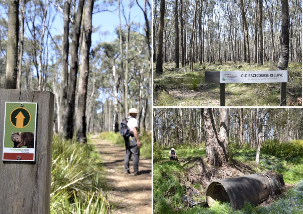
But just before we do, we encounter a couple of surprises: the first being the remnant chimney of a long-crumbled dwelling ensconced in a weedy but pretty swamp of forget-me-nots, and the second a large rusted historic boiler, a relic from the area’s past that features both gold mining and forestry. The latter helped to keep Dr Wisewould plenty busy.
At this point the canopy above us starts to become pretty impressive with some remarkable tall trees.
Crossing the Trentham-Blackwood Road, we enter the forested section of the walk and soon find fresh evidence of the trail’s namesake animal in residence. From here the trail offers a good bushland experience and further on ahead, the historic site of the former 1800s Trentham Racecourse – unused since 1907.
This is like no racecourse site you’ve ever seen before. In fact, were it not for the signage, you’d never pick this as having been a racecourse, let alone a 1.6km course that once boasted a grandstand.
Here, we’re surrounded by forest, an under-story featuring native grasses and a eucalyptus canopy through which the wind rushes in bursts like a restless inland sea. Myriad tiny white and purple native violets, sprinkled like micro fairy lights are abundant along this section of the trail.
We walk on, now navigating the forest-engulfed 1.6km racecourse loop that once hosted pounding hooves – anticlockwise as they would have raced – stopping where the grandstand once stood to imagine long-gone mug punters losing their pennies on punts and pints.
Having completed the racecourse circuit we stop for a well-earnt trail side tea break imagining ghost horses with flaring nostrils and thundering hooves… Perhaps it’s just the canopy zephyr?
From here it’s not far back to the township and the Quarry Street Reserve with its handy amenities, parking and proud new wood duck families enjoying the pond. Reflecting that we only encountered three other people along the entire trail, Paddy H and I celebrate the satisfactory completion of this little gem of a walk with a couple of bags of crisps. At 9kms, Trentham’s Wombat Trail is just the right length to tackle if you want a walk that gets you into the forest, with some unique points of interest in the mix, even if you’re strapped for time.