August 26th, 2023New Glenelg Highway bike path taking shape

The Ballarat City Council has invited community feedback on where rest stops, seating and crossings should be located along the Glenelg Highway Bike Path.
The City of Ballarat is currently designing the 3.4 kilometre bike path along the Glenelg Highway which will connect Delacombe Town Centre and the Yarrowee River Trail.
The Glenelg Highway Bike Path works will create a shared path connecting Delacombe Town Centre and the Yarrowee River with provision of safe off-road cycling is a key aspect of transitioning Ballarat towards a more sustainable future.
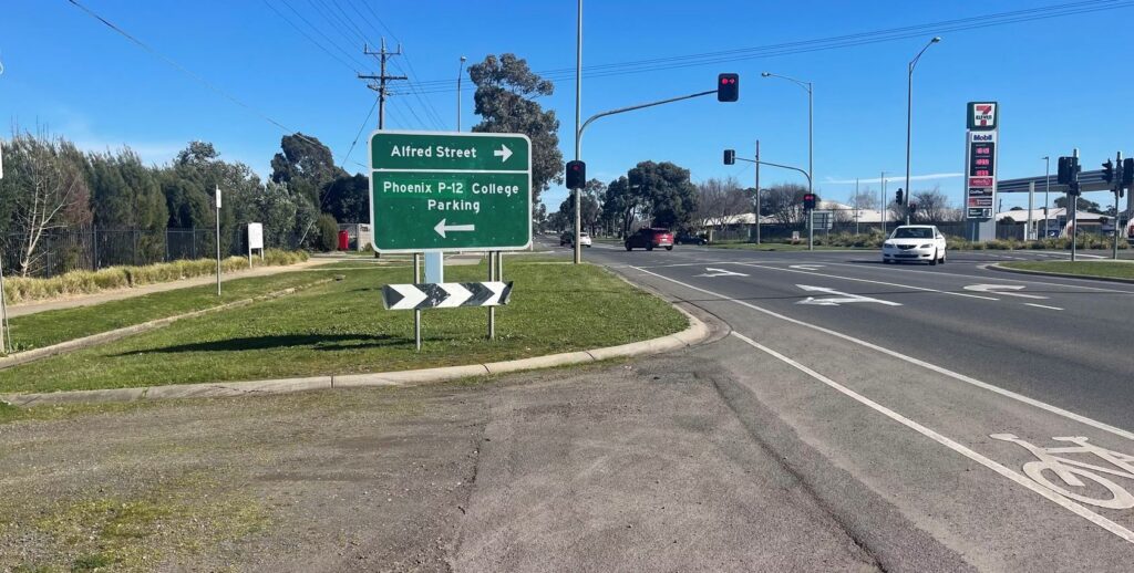
While the council is designing the whole path now, delivery will take place in three stages with the first stage focusing on safer crossings for Phoenix College funded for delivery this financial year.
 Glenelg Highway Bike Path Stages Design works have been endorsed by the Spotlight on Sebastopol Community Reference Group and supported with funding from the State Government. This reference group is composed of local community members and is tasked with selecting key projects to improve the accessibility, walkability and amenity of Sebastopol and surrounding areas.
The Proposed Design
The proposed location for the path is the southern side of the Midland Highway utilising the shoulder and on road space between the kerb and existing trees. This alignment is guided by the need to safely access Phoenix College and the recent intersection works at Midland Highway. Where possible, existing parking and access will be retained or improved. Raised wombat crossings are proposed at intersections and crossroads.
In a media statement the council has said that “existing trees that are healthy will be retained and new opportunities for additional tree planting will be identified”.
Rest points are proposed along the path with seating, bins and cycling infrastructure like hoops and bike repair stations.
The stated goals of the project are:
- facilitate active transport for commuters and students with safe, raised crossings for Phoenix College.
- create a safe, comfortable riding and walking path for recreation with links to the Yarrowee River Trails.
- increase pedestrian and cyclist safety through a dedicated path and raised crossings at intersections.
- preservation of existing healthy trees through pruning and mulching.
- increasing provision of greening and natural shade through tree planting.
- creating seating nodes or rest points with cycling infrastructure.
Stage 1 construction is funded and will see the link between Phoenix College and Beverin Street built in 2024. Design of the full path is funded by Regional Roads Victoria (RRV).
Stage 1 construction works are funded by Regional Development Victoria’s Spotlight on Sebastopol program with construction of future stages dependant on availability of funding opportunities.