
January 20th, 2024Walks of the Central Highlands

with Eve Lamb
Lalgambook (Mount Franklin) crater rim walk
If you haven’t yet done the Lalgambook (Mount Franklin) crater rim walk, now’s a great time to get cracking.
I first sampled this little must-do hike several years ago as part of a longer guided walk led by Professor Barry Goanna Golding AM. The guided Golding trek had focussed on the significant Dja Dja Wurrung Aboriginal history of the wider landscape here, particularly including the Franklinford area, known to the Dja Dja Wurrung people as Larne-ne-barramul or the home of the emu.
Ever since then, I’ve always wanted to return to take a little longer to focus on the ancient extinct volcanic feature itself. This prominent local landmark, Lalgambook (648 metre elevation) is part of the Hepburn State Regional Park jointly managed by Djaara (Dja Dja Wurrung Clans Aboriginal Corporation) and Parks Victoria.
The crater circuit stroll is just 1.7 km in length, so there’s few excuses for not doing it. But despite its very leisurely post-lunch length, that won’t do much to enhance your reputation as a serious bushwalker or rid you of that extra padding acquired over the festive season, this is a great little short walk.
To properly appreciate it, it’s best to understand something of both the geomorpholology of this ancient area and the Aboriginal mythology and significance of Lalgambook (Mount Franklin).
Situated about 10 km north of Daylesford and accessed off the Midland Highway via a road that traces an ancient breach path of lava exuded from the crater, Lalgambook was created by a fiery volcanic eruption about 470,000 years ago. Today it’s classed as a prominent, breached conical scoria cone with a deep crater.
The resultant caldera (large crater, formed by the eruption leading to the collapse of the volcano mouth) is one of the deepest in the Central Highlands.
Lava flow from Mount Franklin and other volcanoes that preside over the surrounding rolling ancient plains had buried gold-bearing creeks that would become the ‘deep leads’ sought out and excavated by gold miners during the subsequent rush era.
The volcanic eruptions of Mount Franklin are believed to have been witnessed by members of the Dja Dja Wurrung Aboriginal tribe who referred to this ancient country as the ‘smoking grounds’ and to the mountain itself as Lalgambook.
The literature records that “Mount Franklin and the surrounding area appears to have been a place of considerable significance to the Aboriginal people. Both ethnographical and archaeological evidence indicates that frequent large ceremonial gatherings took place in the area.”.
Research had also led me to the following traditional creation story, as previously told by Justice B Nelson – Dja Dja Wurrung, Jaara – and published by Culture Victoria, telling the tale of two feuding volcanoes named Tarrengower (overlooking today’s township of Maldon off to the north) and Lalgambook:
“A long, long time ago, long before anyone but the Traditional People walked our Country, our lands, rivers, mountains and animals alike, all had magical life. They had personalities, purpose, speech and they could think for themselves.
Tarrengower in the Dja Dja Wurrung means to be big and heavy and indeed he was just that; big, bold, wise and a very proud old volcano who had become very tired throwing out rocks and lava and preferred to sit humbly watching over the plains.
Another volcano called Lalgambook was a young, loud and cheeky volcano that started to challenge old Tarrengower’s wisdom and authority, and began grumbling and building up anger towards the old volcano. But Tarrengower, being the wise old volcano that he was, decided he should just try to ignore this cheeky little volcano.
Lalgambook grew even angrier that Tarrengower wasn’t acknowledging his threats and started to put on a display of smoke, ash and brimstone to impress the land and animals who were also watching, but this didn’t intimidate the wise old Tarrengower. Instead he just laughed at Lalgambook.
Lalgambook became so frustrated that he began to throw large rocks at Tarrengower who grumbled with annoyance at this cheeky volcano and Tarrengower now began to taunt young Lalgambook by telling him he wasn’t very strong at all because the rocks couldn’t reach him.
Lalgambook exploded with great fury, spurting out lava and smoke high into the sky and hurled gart gart in Tarrengower’s direction, but still could not reach him. This caused Lalgambook to completely blow his core!
Tarrengower’s anger eased and he just grumbled at this cheeky little volcano who was now just coughing and spluttering with no energy left at all.
All the rocks thrown by Lalgambook at Tarrengower can still be seen today and have formed what is known in the present day as the Guilford Plateau where the Jaara people would perform ceremonies on the Bora grounds also known as Yapene.”
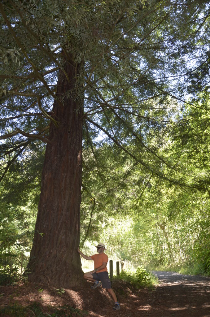
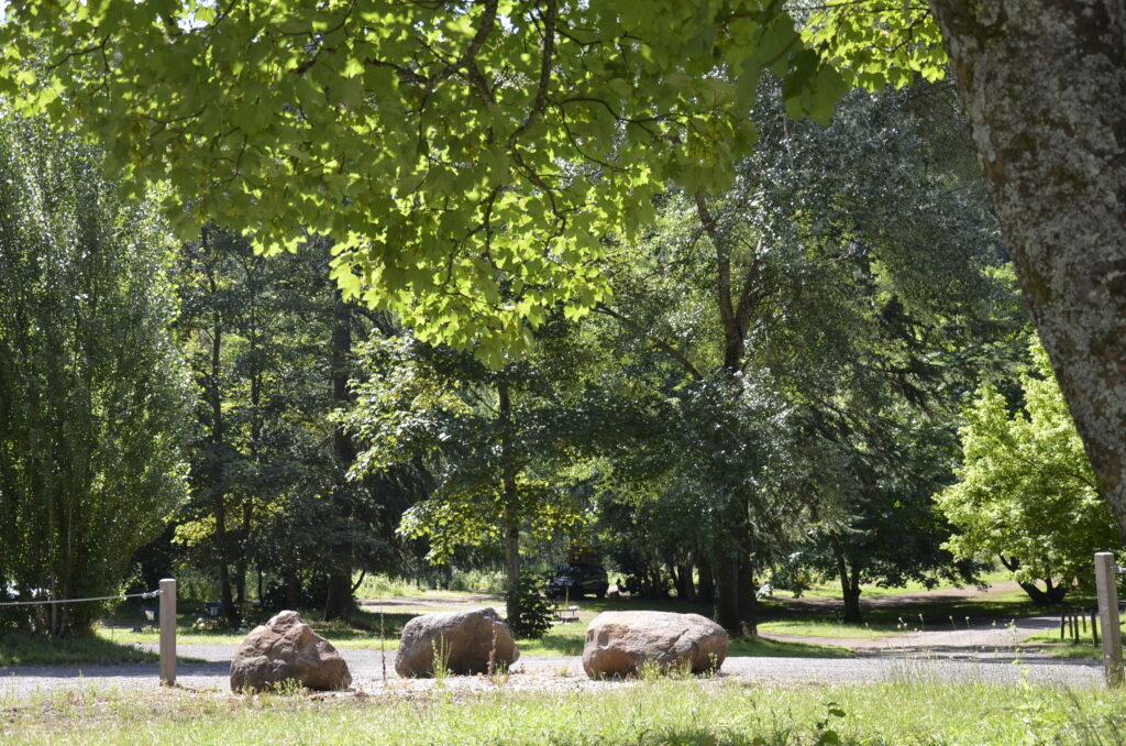
Reflecting on this lively heritage, my tireless walking companion Paddy H and I elect to start with a picnic inside the Lalgambook caldera which these days is an arboretum featuring established leafy exotics including silver birch, white poplar, sycamore and Sequoia sempervirens (Californian Redwoods).
It’s an attractive spot offering free camping complete with composting loos, and following our lazy picnic here, we start out on the signposted crater rim walk from the western side of the caldera.
It’s a very gentle climb through pine trees and other exotics, gaining some expansive views to the west to gradually reach the summit.
All the while I’m keeping an eagle eye out for rumoured semi-precious gemstones as I remember Prof Golding saying something about their being here. I’ve since read that, as a consequence of the now extinct volcano erupting all of those thousands of years ago: “the coarse ejecta exposed around the summit includes red and green olivine and megacrysts of high-temperature (some of the largest known Victorian examples) and orthoclase (to 7 cm long) and augite (over 9 cm long).”
Megacrysts? The potential research associated with this place is probably endless…
By about the half-way mark I still haven’t located any megacrysts, but we’ve reach the summit telecommunications tower and don’t spend too much time here before we begin the descent, sunlight filtered and flickering through the pines.
It need be noted here that the country around Mount Franklin was described in 1855 as “thickly timbered with box and stringbark”. Unfortunately, in 1944, a devastating bushfire destroyed most of the native vegetation on the mount.
As a result, the inner and outer slopes of the crater were planted with the exotic species we see today, mainly conifers. The caldera was planted with the leafy ornamentals I mentioned earlier, and whose shade we soon reach again to find that during our walk, more campers have rolled up to forest bathe in its charms.
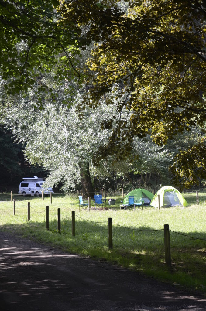
At this time of the year, summer school holidays, the short but heritage-rich Lalgambook crater rim walk is a choice option for young families to sample, while this beautiful leafy free camping and picnic area is well worth a visit in its own right.
Words and Images: Eve Lamb